Lakes3

Mosedale

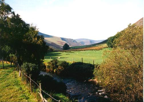
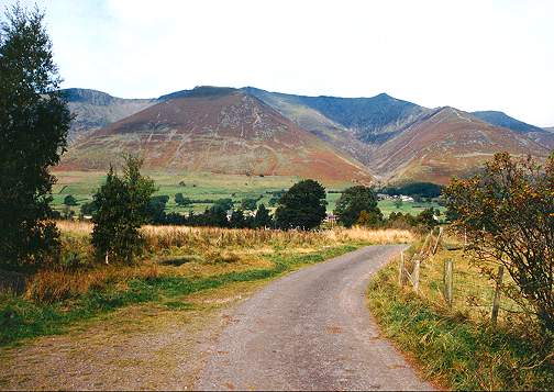
Mosedale is one of the many small settlements in this area which are from old norse origins. Mosedale means valley of the peat from the word mosi, the norse for peat moss. The Norsemen apparently arrived in this area around 900 A.D. and used peat as a fuel source. Almost all of the wide valley to the east of Mosedale consists of peat bogs which have colonised what was a large lake many thousands of years ago.


Mosedale valley

All Photos Copyright © D.Hickson 2001. All Rights Reserved

Legend suggests that two immortal fish live in the tarn on Bowscale fell. Wordsworth wrote about these fish which made the tarn such a popular attraction that a track to cater for victorian tourists in horse drawn coaches was constructed. The track begins behind Bowscale Farm and leads up the left side of the Mosedale valley

Mosedale village


A narrow dead end road begins in Mosedale village and follows the course of the River Caldew up the Mosedale valley to end at the site of the now disused Carrock tungsten mine. This road was renovated 40 or so years ago when plans were afoot to build a reservoir here, fortunately nothing materialised. The northern side of the valley holds almost a forest of juniper trees, an unusual vegetation type in the Northern Fells. Carrock mine has been reopened several times to exploit the high world prices for certain mineral types. The Carrock fell area is geologically complicated and the veins within the mountain are characterised by their diverse mineral compliment. Lead was probably the mineral that led to the initial commercial mining operation, but apparently copper and even gold (in small quantities) have been found here. Most of the mine site has now been bulldozed and landscaped, unfortunately destroying much of the industrial archeological remains. However it is still possible to find some interesting rock crystals among the flattened spoil heaps. At the end of the road near the river there is a fine sheltered sun trap which is now very popular with local people especially at weekends. As the Cumbrian Way footpath now also comes through here, the chances of finding isolation and tranquility are less likely than in the past.

.


.

Mungrisedale Village

Mungrisedale village lies on the Eastern edge of the Caldbeck fells and apparently takes its name from St. Mungo's valley of the pigs. There are some spectacular views from Mungrisedale; the following photograph shows Bowscale Fell on the right, The Tongue in the centre and Bannerdale crags to the left which leads onto Blencathra, one of the major Lakeland peaks. There is some excellent hillwalking in this area.
The Tongue

.
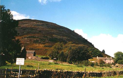
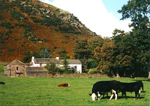
Many of the farms in this area date from the 17th century and some have datestones over their doorways which show their exact time of construction.


Mungrisedale Farm

.

.


.

Blencathra

.

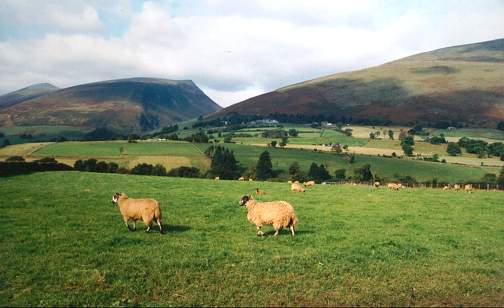
Blencathra, also sometimes called Saddleback due to it's similarity to a saddle when viewed from the east, is possibly one of the Lake District's most charismatic mountains. Indeed Wainwright devotes 35 pages to Blencathra in his Guide to the Northern Fells. A book which is an essential purchase for every visitor to this area. For those who enjoy fell walking, Blencathra has something for everyone. There are three ridges leading to the sunmmit from Threlkeld village, there is the route from Scales leading on to Sharp Edge, which should get everyones adrenaline flowing, especially if there is a gusty wind and there are also easy routes from the west and east.


Blencathra

.

The following photo shows the western slopes of Blencathra with the crags of Lonscale fell to the left. Along the valley between these fells is an easy footpath with no major uphill sections. The valley is quite steep sided with good scenery. There is a small car park above the Blencathra Centre with easy access from here to the walk. The path eventually leads on to Skiddaw House, with a choice of paths from here leading to Mosedale or towards Bassenthwaite. You may possibly just want to walk so far and then return the same way.


Lonscale Fell
The Blencathra Centre is part of the Field Studies Council and runs some excellent courses, many directly related to the Lake District. The Field Centre is the group of buildings in the middle of the previous photo. From the Centre there are spectacular views into St John's in the Vale.

.


Castlerigg Stone Circle

.

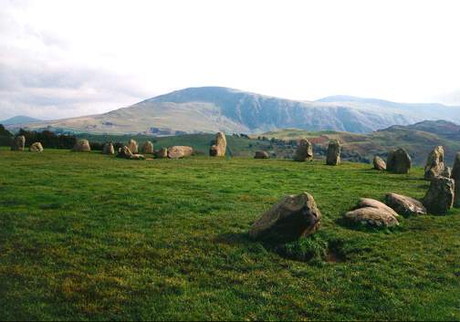
Castlerigg stone circle is situated only about a mile east of Keswick. The circle consists of 39 stones arranged in a circle of approximately 30metres diameter. The circle is believed to date from the late Neolithic or Bronze ages and could possibly be well over 3000 years old.


stone circle

The exact purpose of the circle is unknown, but theories exist that it may have been a site of pagan worship or that it was used as a type of astronomical calender or as a focal point for traders to meet and exchange their goods or possibly a combination of several or all of these theories. In a way it is better that we do not know it's purpose, because we can then quite legitimately compound our own theory when we vist the site. What is indisputable is the beautiful setting of the circle which looks out on several valleys radiating outwards, producing some spectacular views.

CLICK. CONTINUE.....OR..... LAKE DISTRICT INDEX

.