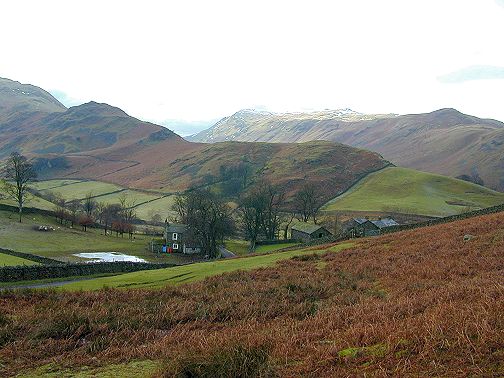
Place fell is the fell with snow beyond Beda Head. This photo was taken from near the carpark at St Peter's church. Sandwick lies off the photo to the right. There are a lot of crags around Place Fell and therefore a large scale map is a requirement of this walk.
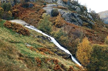
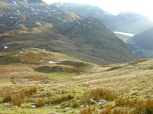
The walk starts at the car park in Sandwick near the shore of Ullswater. The path to follow is the one signposted Patterdale. After 1km and having passed a large stonewalled enclosure the left fork of the path is taken, heading towards Scalehow Force waterfalls. See following photo.
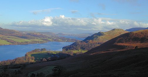
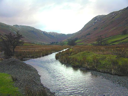
Near the waterfalls and looking back towards Sandwick there are some good views of Hallin fell, with it's lovely oak woodland on the lower slopes, and also down the length of Ullswater towards Pooley Bridge.
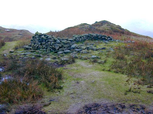
A little further on, above the falls, is a very small slate quarry which is probably the reason for the existence of the track.
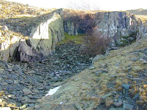
Only a few feet away from the quarry is a ruined building, which is large enough to have used up nearly all of the stone from the quarry. Was it a quarry workers shelter or was it an agricultural building with the quarry opened up with the sole purpose of providing stone to build it? Whatever the reason both the quarry and the building are very remote from other habitation.
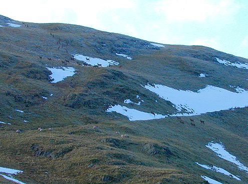
The following photo is of a group of 36 red deer, consisting of both stags and hinds. The deer here are quite accustomed to walkers and can be approached fairly close and they don't run too far if disturbed. These deer were at a distance of perhaps 100 metres, but with a standard camera lens they appear only slightly more than specks! One of the local hill farmers told me that he thought there were perhaps 300 deer on Place Fell in the winter. On my January walk I saw between 80 and 100. The deer numbers appear to be increasing, possibly helped by the improved habitat for them around Thirlmere.
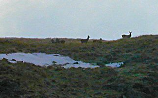
Another bad photo of deer a little further along the track. My excuse is that it was blowing a blizzard when I took the photo!
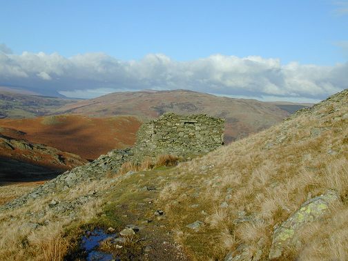
From the summit of Place Fell in clear weather there are some good views of Blencathra, Helvellyn and other fells to the west. However not in a snowstorm, so no photos here. Leaving the summit it is essential to follow the track as there are many dangerous crags in this area. If you lose the track look for a rocky knoll south east of the summit beyond which is a cairn marking the steep route down to Boredale Hause. See following photo.
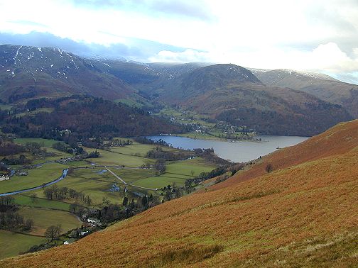
When the track passing over Boredale Hause is reached , before turning left into Boredale it is worth going to the right a short distance to take in the view over Patterdale. The following photo shows the ferry terminal at Glenridding which is virtually joined on to Patterdale. The delta, where the ferry terminal is , was caused by mine waste being washed down into the lake from the tips higher up the valley. The problem of lead pollution in the lake and the deposition of silt was so bad that the mining practices had to be changed.
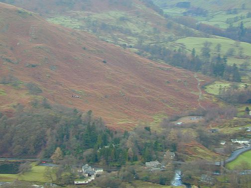
The Ullswater valley and many others are used for low flying practice by the RAF and it is a little strange to be looking down at an aeroplane rather than up. Look for the tiny RAF trainer in the following photo.
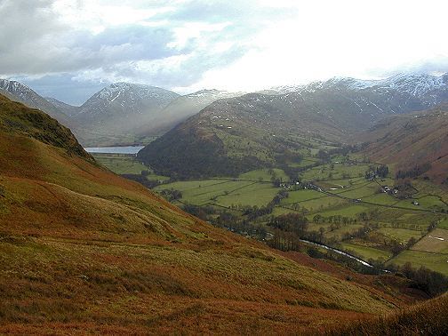
Looking up the valley from Boredale Hause there are good views of the approaches to Kirkstone Pass.
In the centre of Boredale Hause is an old ruined building which apparently has always been known as the Chapel in the Hause and indeed it is marked on the OS map with this name. Apparently this building had exactly the same dimensions as St Ninians chapel on the Isle of Whithorn and theories suggest that this too may be attributable to St Ninian. If this were found to be correct it would mean that this ruin would be 1500 years old.
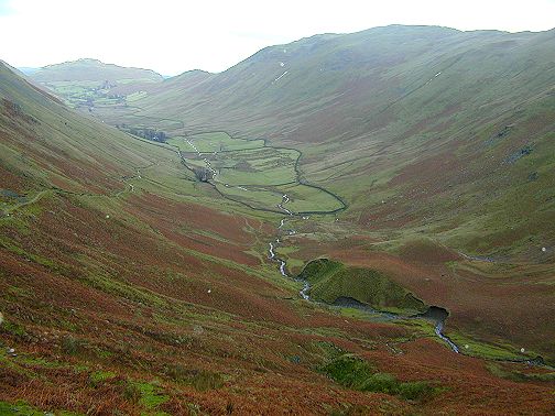
The initial descent from the Hause into the Boredale valley is quite steep with much loose rock. Boredale is an excellent example of a glaciated U shaped valley and there even appears to be the remnants of a glacial morain at the valley head which has now been cut through by the beck. One presumes, that in the past, it had held back a build up of water and hence a tarn may have been present. The track soon flattens out into a gentle gradient down towards Boredale Head farm.
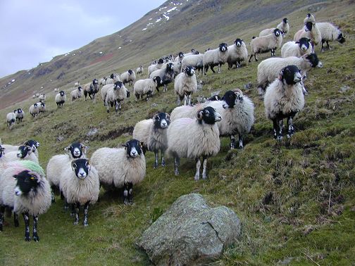
This group of sheep ran down from the fellside and appeared to pose, wanting their photo taken or maybe they just thought I was the farmer.
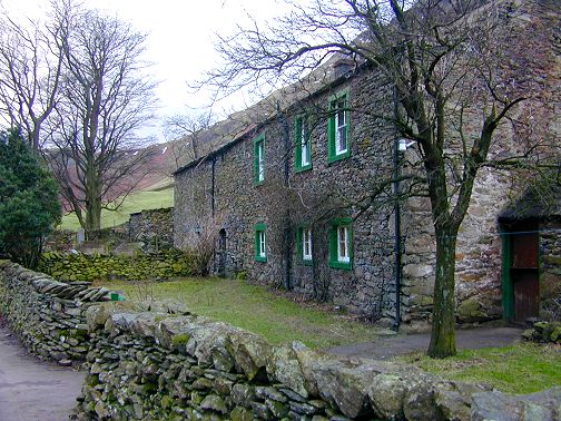
When I was doing this walk I was told by a local farmer that there are now only 3 working farms left in these Martindale valleys. It appears that Boredalehead is one of these. It is typical of the architecture of central lakeland where rough angular volcanic slate is used in the construction of buildings with little or no visible mortar
Boredale Beck appears to be quite a large size for such a small catchment area, but the high lakeland rainfall probably accounts for this. In January dippers were singing excitedly on this beck in their quest to attract a mate and maintain their territory.
To end this walk involves about a further half hour by road. It is quite pleasant to walk along the roads in these valleys because in many cases there is a flat cushion of springy turf alongside, which can be used if the tarmac surface becomes too jarring
If you have enjoyed looking at this Lake District section please send me an email with your comments. If you have any unusual information about any of the places either past or present or suggestions for other areas I should include please click on email link d.hickson@btconnect.com
Last updated 11th Jan 2001